22-05-2013
 |
| Canchal de la Ceya |
 |
| En route to El Calvitero |
Canchal de la Ceya -Sierra de Bejar
Started from 1863m high carpark Plataforma del Travieso (1850m) N40.33503 W5.73245. As I was getting
ready to go three young men turned up and headed off up the hill. I
deliberately let them go off ahead of me in the hope that if they were going my
way that they could do the hard work of navigating and pioneering through the
fresh snow and I could literally follow in their footsteps. There first bit was
a bit odd and hard going, however, they soon picked up a path that starts from
the near end of the car park from the main road from Bejar. Despite my best
efforts to keep behind them I still overtook them before we reached the summit
of El Calvitero and then they turned back anyway. Aren’t some people odd, fancy
going for a walk on the hill without being a bagger?
 |
| El Calvitero |
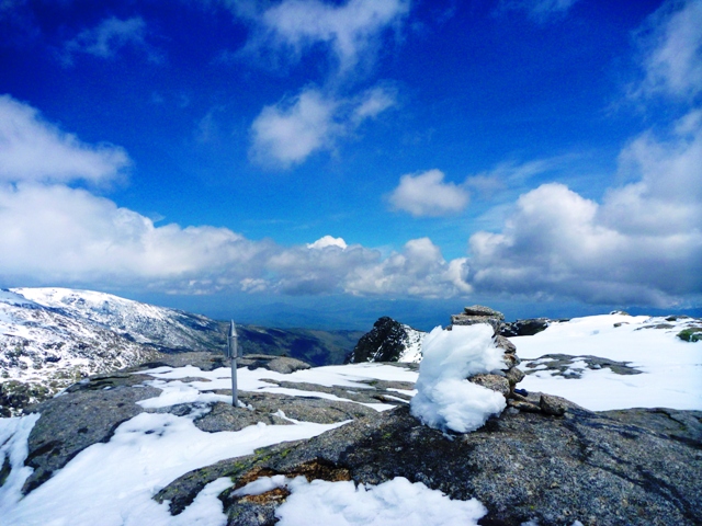
I continued to pioneer to El Calvitero (2399m) N40.31731 W5.72399, marked by a
metal tube, and then dropped down to the snowfree col (2326m) N40.30935 W5.73041 before, heading back
into the drifting snow on the final uphill stretch to the summit of Canchal de
la Ceya, Major 2430m P1153 N40.30457 W5.72899. The summit near the edge of a steep corrie wall is marked
by a cairn and a silver space rocket. As I was still a bit tired from the
previous day’s exertions on Almanzor and I had a long drive ahead of me, I
decided to forgo exploring the El Torreon crags and head back.
 |
Going back I foolishly left for a while the route I had
pioneered and ending up flogging through more fresh snow. However, it meant
that the route was a bit shorter and going down is easier than up, although not
when the snow is hiding dwarf pine trees.

5.5hrs, 11.45km, 1036m ascent

 I then drove into Portugal for the first time in my life,
crossing the border at Fuentes de Onoro (E) and Vilar Formosa (P) to spend the
night in a service area near Guarda on the edge of the Sierra de Estrala.
I then drove into Portugal for the first time in my life,
crossing the border at Fuentes de Onoro (E) and Vilar Formosa (P) to spend the
night in a service area near Guarda on the edge of the Sierra de Estrala.
No comments:
Post a Comment